


General |
|
| DIMENSION | 11.9" x 8.5" x 3" (30.3 cm x 21.6 cm x 7.6 cm) |
|---|---|
| WEIGHT |
6.2 lbs (2.8 kg) |
| WATERPROOF |
IPX7 |
| TOUCHSCREEN | |
| DISPLAY TYPE | FHD, IPS |
| DISPLAY SIZE | 10.1" x 5.7"; 11.6" diagonal, 25.7 cm x 14.5 cm; 29.5 cm diagonal |
| DISPLAY RESOLUTION | 1920 x 1080 pixels |
| MOUNTING OPTIONS | Bail, flat or flush (Garmin does not offer any hardware or accessories for a flat-mount installation. Professional tools and knowledge is required.) |
Maps & Memory |
|
| ACCEPTS DATA CARDS |
2 microSD cards |
|---|---|
| WAYPOINTS |
5000 |
| TRACK POINTS | 50,000 |
| TRACKS | 50 saved tracks |
| NAVIGATION ROUTES | 100 |
Sensors |
|
| GPS | |
|---|---|
| GLONASS | |
| GALILEO | |
| HAS BUILT-IN RECEIVER | |
| RECEIVER |
10 Hz |
| NMEA 2000 COMPATIBLE | |
| NMEA 0183 COMPATIBLE | |
| SUPPORTS WAAS | |
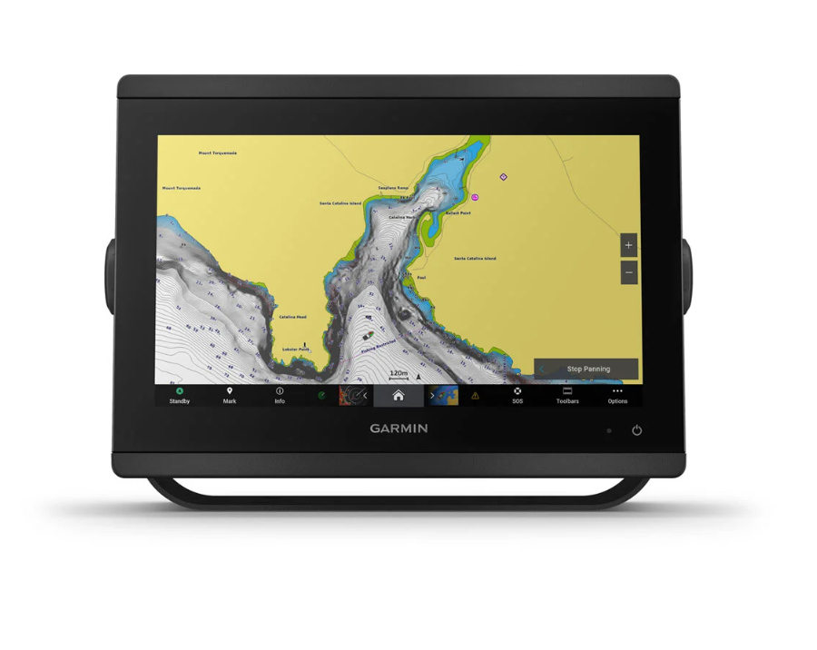
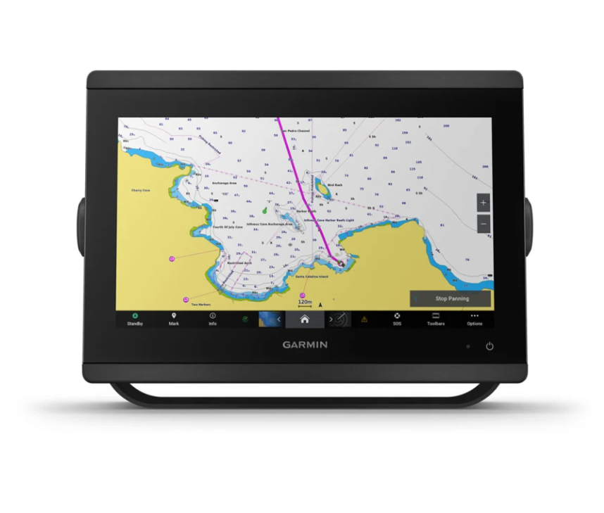
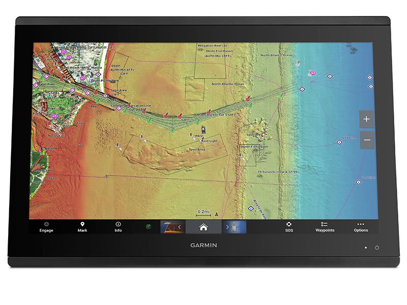
Built-in maps |
|
| BUILT-IN AUTO GUIDANCE | |
|---|---|
| TIDE TABLES | |
Optional map support |
|
| BLUECHART G3 | |
|---|---|
| BLUECHART G3 VISION | |
| LAKEVÜ G3 | |
| LAKEVÜ G3 ULTRA | |
| GARMIN NAVIONICS+™ | |
| GARMIN NAVIONICS VISION+™ | |
| TOPO 100K | |
| STANDARD MAPPING | |
| GARMIN QUICKDRAW CONTOURS | |
| RASTER CHART SUPPORT | |
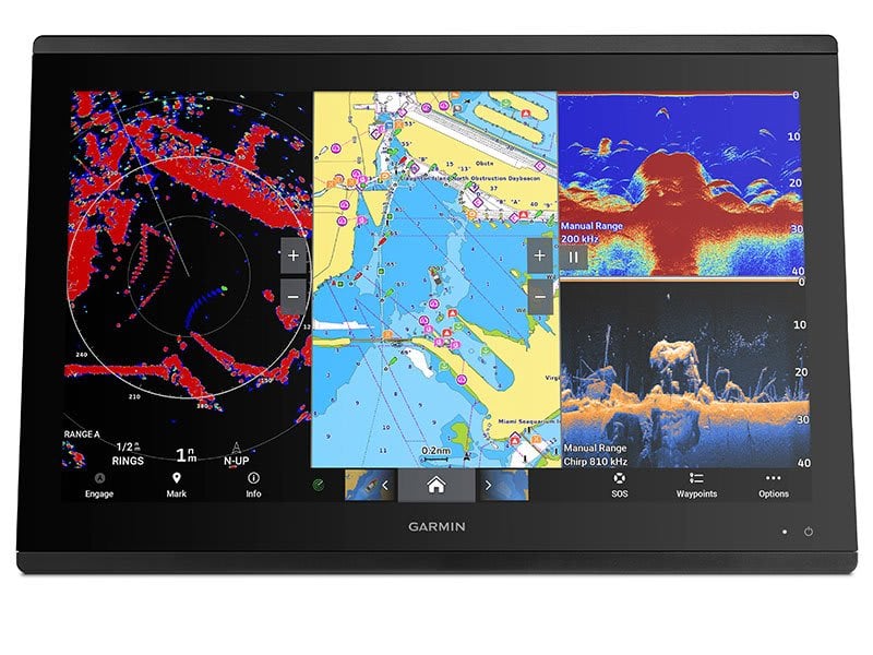
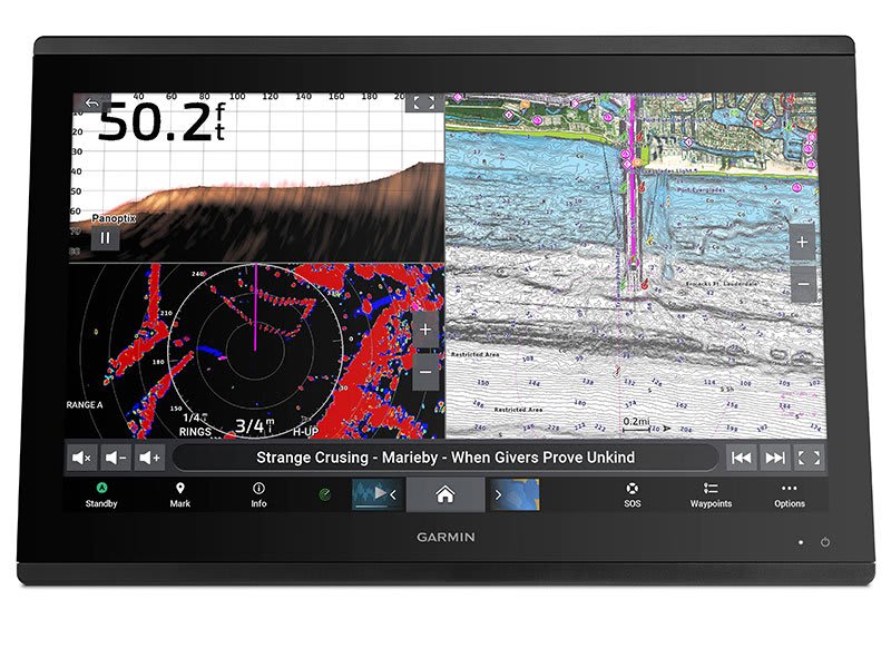
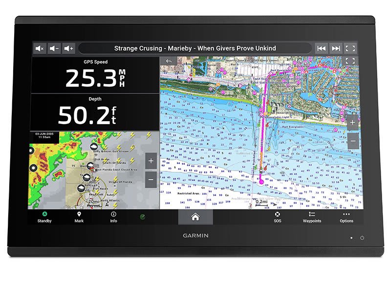
Chartplotter Features |
|
| SMART MODE COMPATIBLE | |
|---|---|
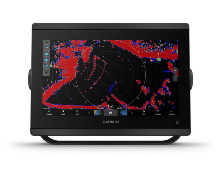
| AIS | |
| DSC | |
| SUPPORTS FUSION-LINK™ COMPATIBLE RADIOS | |
| GSD BLACK BOX SONAR SUPPORT | |
| GCV BLACK BOX SONAR SUPPORT | |
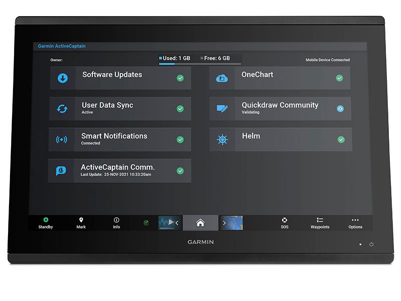
| ACTIVECAPTAIN MOBILE PLANNING COMPATIBLE | yes |
| GRID (GARMIN REMOTE INPUT DEVICE) COMPATIBLE | |
| WIRELESS REMOTE COMPATIBLE | |
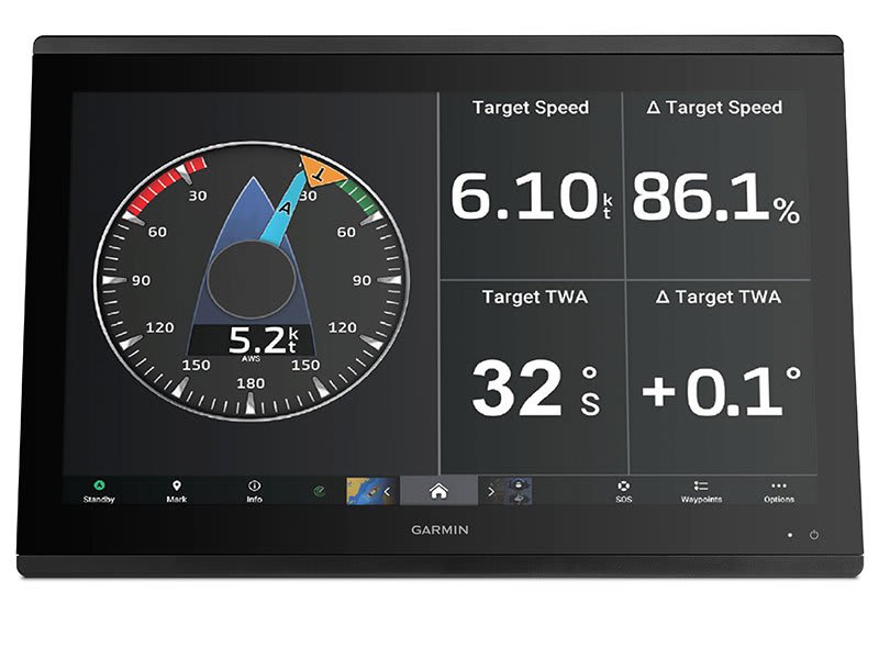
| SAILING FEATURES | |
| SPOKEN AUDIO ALERTS | |
| ONEHELM SUPPORT | |
Electrical features |
|
| POWER INPUT | 10-32 Vdc |
|---|---|
| TYPICAL CURRENT DRAW AT 12 VDC | 1.3 A |
| MAXIMUM CURRENT DRAW AT 12 VDC | 6.0 A |
| MAXIMUM POWER USAGE AT 10 VDC | 45W |
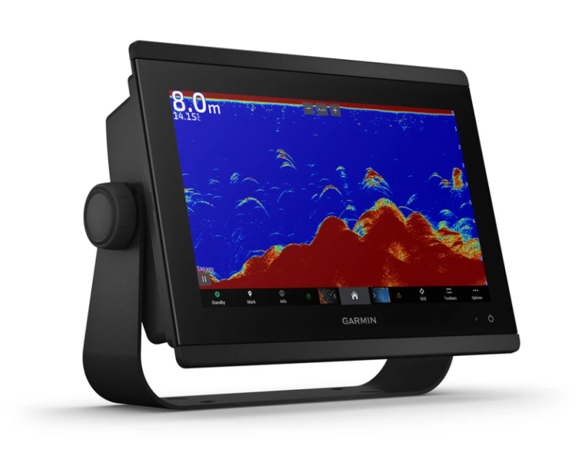
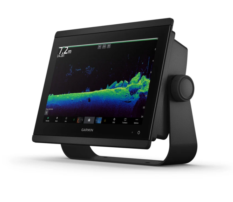
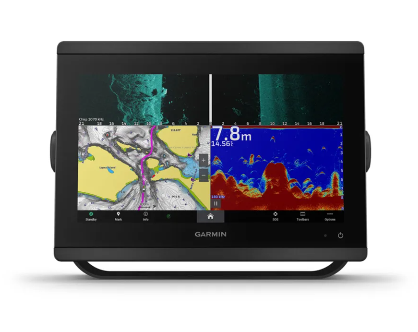
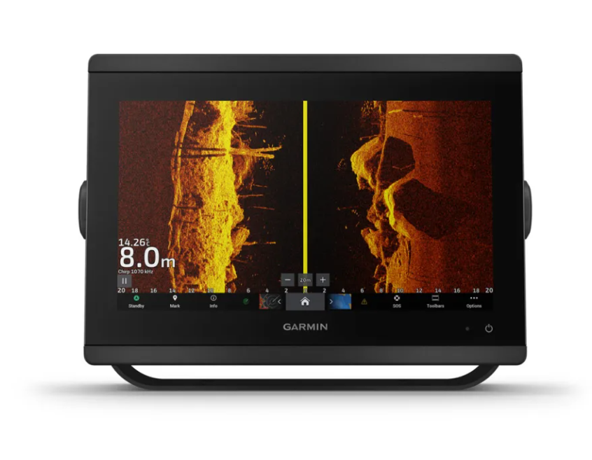
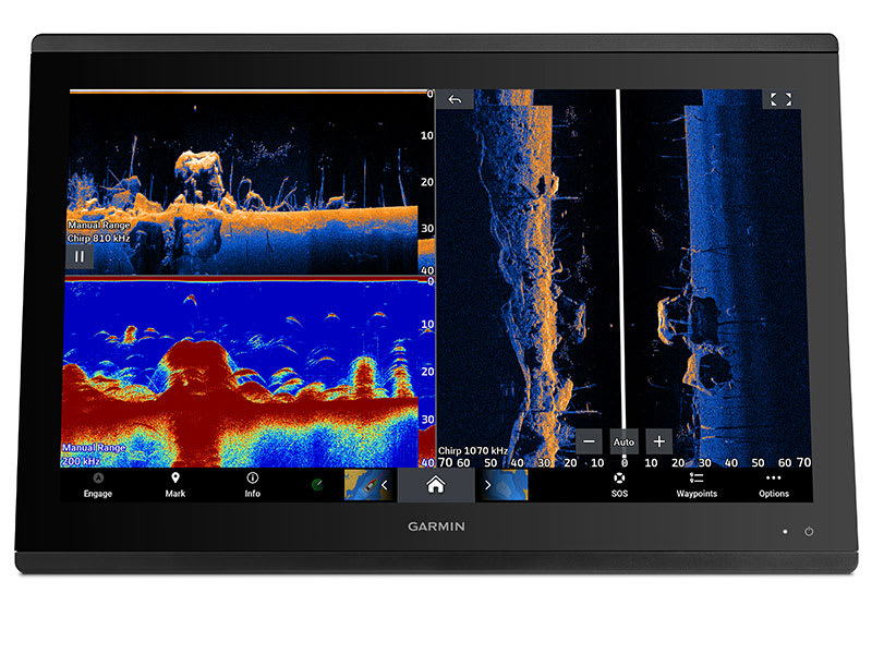
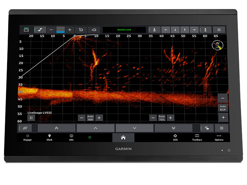
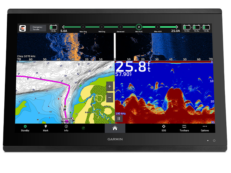
Sonar Features |
|
| DISPLAYS SONAR | |
|---|---|
| POWER OUTPUT | 1 kW |
| TRADITIONAL SONAR (DUAL FREQUENCY/BEAM) | Built-in (dual channel CHIRP, 70/83/200 kHz, L, M, H CHIRP) |
| CLEARVÜ | Built-in 260/455/800/1000/1200 kHz |
| SIDEVÜ | Built-in 260/455/800/1000/1200 kHz |
| PANOPTIX™ SONAR | |
| LIVESCOPE | |
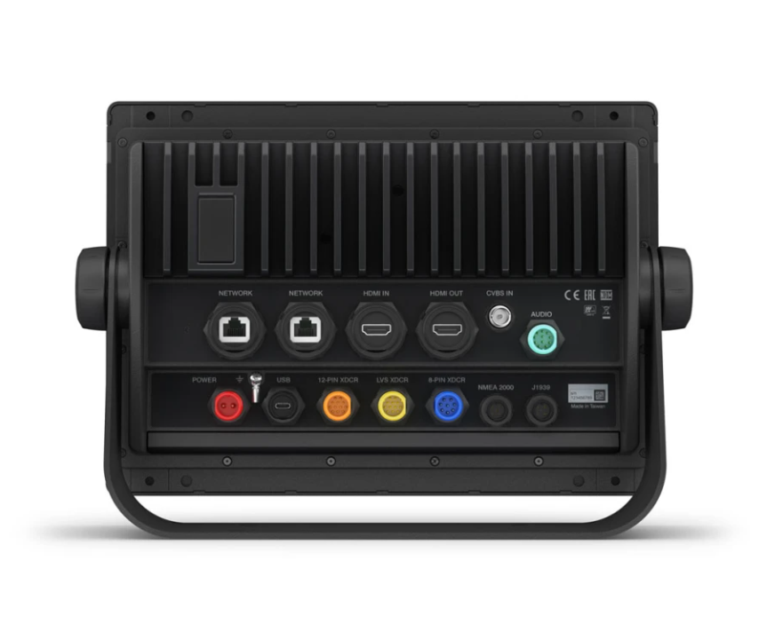
Connections |
|
| NMEA 2000® PORTS | 1 |
|---|---|
| CONNECTIONS NMEA0183 INPUT PORTS | 1 |
| NMEA 0183 INPUT (TX) PORTS | 1 |
| VIDEO INPUT PORTS |
1 (BNC composite); 1 HDMI (HDCP compliant) |
| VIDEO OUTPUT PORTS |
1 HDMI |
| J1939 PORTS | 1 |
| GARMIN MARINE NETWORK PORTS |
2 |
| 8-PIN TRANSDUCER PORTS | |
| 12-PIN TRANSDUCER PORTS | |
| USB PORTS | |
| BNC EXTERNAL GPS ANTENNA PORT | |
| BLUETOOTH® PAIRING | |
| ANT+ (CONNECTIVITY) | |
| GARMIN WI-FI NETWORK (LOCAL CONNECTION) | |