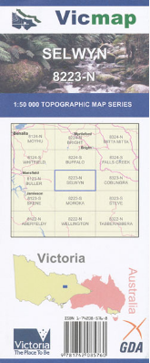

Description
Selwyn 1-50,000 Topographic Map 8223N Vicmap
Selwyn 1-50,000 scale Vicmap Topographical map is used for Walking, 4WD, Fishing, Camping, Motorcycle, both On and Off Road, Gold Prospecting and for those simply going for a family weekend drive.
Topographical maps show not only Contours of the Terrain but Walking Tracks, Sealed and Unsealed Roads, Rivers, Creeks, Lakes, Historical Points of Interest, Old Mine Sites mbtg and National and State Park areas.
Main Features of this map includes:
Wonnagatta Station
Mt Howitt
Mt Selwyn
Mt Buggery
Australian Alpine Walking Track Section
Devils Staircase
Bluff Hut
Mt Speculation
Mt Despair