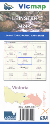

Description
Lienster 1-50,000 scale Victorian Topographical map 8424S is used for Walking, 4WD, Fishing, Camping, Motorcycle, both On and Off Road, Gold Prospecting and for those simply going for a family weekend drive.
Topographical maps show not only Contours of the Terrain but Walking Tracks, Sealed and Unsealed Roads, Rivers, Creeks, Lakes, Historical Point of Interest, Old Mine Sites and both National and State Park areas.
Main Features of this map includes:
Benambra
Mount Wills
Mount Miswery
Mount Lienster
Mitta Mitta River
Lake Omeo
MacFarlane Lookout
Wombat Creek