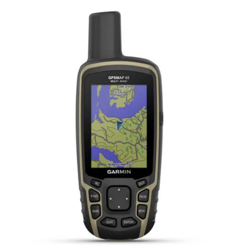
Explore more with this rugged handheld that offers optimal tracking accuracy, a 2.6-inch colour display and preloaded maps.
| Lens Material |
chemically strengthened glass
|
| Dimension |
6.1 x 16.0 x 3.6 cm |
| Weight |
217 g with batteries |
| Water rating |
IPX7 |
| Display Type |
Transflective, 65K colour TFT |
| Display Size |
3.6 x 5.5 cm; 2.6-inch diagonal (6.6 cm) |
| Display Resolution |
160 x 240 pixels |
| Battery type |
2 AA batteries (not included); NiMH or Lithium recommended |
| Battery life |
16 hours |
| Memory/History |
16 GB (user space varies based on included mapping) |
| Interface |
High-speed mini USB and NMEA 0183 compatible |
Maps & Memory
|
| Preloaded maps |
Yes (TopoActive; routable) |
| Ability to add maps |
|
| Basemap |
|
| Automatic routing (turn by turn routing on roads) for outdoor activities |
|
| Map segments |
3,000 |
| Satellite imagery |
250 BirdsEye Imagery files |
| Includes detailed hydrographic features (coastlines, lake/river shorelines, wetlands and perennial and seasonal streams) |
|
| Includes searchable points of interests (parks, campgrounds, scenic lookouts and picnic sites) |
|
| Displays national, state and local parks, forests, and wilderness areas |
|
| External memory storage |
Yes (32 GB max microSD™ card) |
| Waypoints/favorites/locations |
5,000 |
| Tracks |
200 |
| Navigation Track Log |
10,000 points, 200 saved tracks |
| Navigation Routes |
200, 250 points per route; 50 points auto routing |
Sensors
|
| GPS |
|
| GLONASS |
|
| Galileo |
|
| QZSS |
|
| High-sensitivity receiver |
|
| GPS compass (while moving) |
|
| Multi-band frequency |
|
Daily Smart Features
|
| Smart notifications on handheld |
|
| VIRB® Remote |
|
| Pairs with Garmin Connect™ Mobile |
|
Outdoor Applications
|
| Compatible with Garmin Explore™ app |
|
| Garmin Explore website compatible |
|
Connections
|
| Connections Wireless Connectivity |
Yes - Bluetooth®, ANT+®
|